|
Philip Spiess
Another down-river historical episode:
THORNTON TRIANGLE AND ENVIRONS
Fernbank Dam: In the early days of my childhood in Cincinnati, my grandfather would occasionally take my sister and me down river to the community of Fernbank on the western side of Cincinnati, there to watch the great Ohio River barges and their towboats being put through the boat locks at Ohio River Dam No. 37, better known locally as Fernbank Dam (this is where we first learned how a lock works). The dam served a very useful purpose, for in my collection of 19th-century photographs of Ohio River steamboats, certain pictures of the river in summer show boats stranded on sandbars due to low water in the hot season (there were times you could even walk across the river to Kentucky), while pictures of the river in winter show boats trapped in solid ice or even crushed by ice floes in the cold season. The dam was installed as part of a river-long system to raise the water level of the Ohio River between Pittsburgh and Cairo, Illinois, to a 9-foot navigation stage to prevent such occurrences.
It was 1824 when Congress first appropriated money for river and harbor work, and thereafter some rather crude early engineering efforts were inflicted on some of the Ohio River sandbars. It was not until about 1871, however, when the U. S. Army Corps of Engineers moved its Ohio River Improvement Team to Cincinnati, that some serious dredging began in the river, along with the construction of some breakwaters. (Concrete pylons, used as ice breakers to break up the ice floes, were also constructed a little later, usually where the current pulls in toward the shore; three of these can be seen in the river near the Kentucky side a short way below the old Coney Island river landing.) But in 1895, under the aegis of the Ohio Valley Improvement Association, planning began for the construction of a series of dams in the river, including a major dam below Cincinnati at Fernbank; however, this dam was not begun until 1905, and it was not until 1910 that Congress passed legislation authorizing complete canalization of the Ohio River.
Completed in 1911 as the major dam in the system dedicated in 1929 [see below], and being at the time the largest movable dam in the world, Dam No. 37 consisted of a lock, 600 feet long and 110 feet wide, along the Ohio side of the river, a series of hinged wickets (known as a “Chanoine” dam), three “bear traps,” and an abutment off the Kentucky shore; its cost was $1,297,924. A “Chanoine” dam consists of a weir-like structure composed of movable wickets, supported on the downstream face by a hinged steel bracket; these may be laid flat on a concrete base during flood stages, thus leaving the river open; they may be raised again when the water drops (they were raised and lowered at Fernbank by an iron hook operated by an attendant in a maneuver boat moving along the dam). When the wickets are up, boats pass through the locks; when the wickets are down, boats pass directly over the dam itself. “Bear traps” were constructions by which the river pool could be quickly relieved of surplus water, driftwood, or ice.
The Ohio River Navigation Monument: Most of the dams built on the Ohio River between 1905 and 1937 were of the “Chanoine” type; the others were either concrete gravity dams (some with movable gates at the crest) or roller dams. To celebrate the completion of this 980-mile long navigation system, consisting of forty-six locks and movable dams along the river between Pittsburgh and Cairo, Illinois, the Ohio River Navigation Monument, often called the “Canalization Monument,” was dedicated by President Herbert Hoover in 1929; its 30-foot high granite obelisk stands in Eden Park on the Ohio River Overlook just south of the Eden Park Water Tower, with sweeping views both up and down the river and of the Kentucky hills.
At the end of the 1950s, this older system of Ohio River dams began to be replaced by a new system of higher dams in order to raise the average water level of the river from 9 feet to a 25-foot depth for new navigational needs, specifically to accommodate the bigger towboats being used to move the barges. (Yes, folks, that’s why we started having more and bigger spring floods: the water in the river was now much higher to begin with.) Fernbank Dam was removed in 1963, though its grounds, just above River Park and including the dam’s office building, powerhouse, warehouse, four lock tenders’ homes, and a garage, were still controlled for some years by the U. S. Army Corps of Engineers for barge repair under the name of the U. S. Engineering Depot and Marine Ways; one lock tender’s house remains in what is now Fernbank Park [see below]. Meldahl Dam, above Cincinnati between Augusta, Kentucky, and New Richmond, Ohio, and Markland Dam, below Cincinnati between Warsaw, Kentucky, and Vevay, Indiana, are now the two ends of the so-called “Cincinnati Pool.” Today the Ohio River navigation system carries the largest amount of commercial traffic of any river in the United States.
Cincinnati’s Smallest Park: But my sister and I often came down to this part of Cincinnati not just to see the dam, but also to see the Indian. Located at the corner of Thornton Avenue and Gracely Drive in Sayler Park (formerly Fernbank, down river from downtown Cincinnati), at approximately 60 feet in length Thornton Triangle is Cincinnati’s smallest park. It is there for the sole purpose of being home to the J. Fitzhugh Thornton Memorial. And who is J. Fitzhugh Thornton, you might ask? Thornton was a prominent and well-liked farmer in the Sayler Park area at the turn of the century (he was familiarly called “General”); his wife, Eliza M. Thornton, erected said monument to his memory in 1912. The Memorial consists of a zinc statue mounted on a cast-iron pedestal base, the pedestal itself featuring, on its four sides, plaques of grotesque antique masks; small fountain basins for the watering of horses are on its eastern and western sides (though the water is usually no longer running). Atop the pedestal is the figure of an Indian.
The Fernbank Indian: The Fernbank Indian statue, although it is the only Indian sculpture in Cincinnati, is, regrettably, not unique to Cincinnati. The statue (purportedly representing an eastern Woodlands Native American but looking more like a cigar-store native) and its pedestal were purchased out of the ornamental sculpture catalogue of the J. L. Mott Iron Works of Trenton, New Jersey (formerly of the Bronx, New York). Jordan Lawrence Mott had invented the first cooking-stove to utilize anthracite coal as fuel (all previous stoves had used wood), and his convenient and beautiful stoves caused his iron company to grow rapidly, eventually gaining a national reputation. It was soon producing not only stoves, but also tubs, sinks, and other bathroom fixtures [my 1976 slide lecture, “Nights of the Bath,” on the history of the American bathroom, given originally at the Cincinnati Historical Society, features a number of Mott company items]; drains, manhole covers, and iron coal-chutes; ironwork fences and gates; and garden statues and benches, fountains, and the like. Marion E. Gridley’s 1966 book, America’s Indian Statues, notes (page 89) that surviving identical Mott Iron Works Indian statues, in addition to the one in Cincinnati (identified locally as “Tecumseh” [see “Along the Great Miami River: Parts I and II” on this Forum]), are located in Barberton, Ohio (where it’s known as “Chief Hopocan” or “Captain Pipe”), in Akron and Lodi, Ohio, at Ishpeming, Michigan (known there as “Chief Ish”), in Calhoun, Georgia (known there as “Sequoyah”), and at the Old Fort, Schenectady, New York; there is possibly one other still extant, although one once located in Cuzco, Peru, was pulled down by the natives, purportedly drunk (on Pisco Sours?), possibly in protest of a North American Indian being depicted instead of a South American one.
But the “Fernbank Indian” (also known as the “Sayler Park Indian”), looking eastward “as if he scented danger approaching from the woods of Muddy Creek” behind him (thus the WPA’s Cincinnati Guide, 1943), has a notoriety extending well beyond any uniqueness, local identity, or pleasing (or not) sculptural aesthetic – it has been the victim of numerous accidents, what one might call “statuary rape.” And first, it was partially submerged in the great Ohio River Flood of 1937 (the highest in the river’s recorded history, which, according to my mother, cancelled mid-term exams at Walnut Hills High School).
Then, in 1940, occurred the most famous accident to the statue: a high-speed automobile knocked the statue off its pedestal and partly shattered it. Unconcerned or uncaring, city officials let it lay there in pieces; Fernbank natives, however, demanded that it be repaired and restored to its pedestal. But it was wartime, and the park commissioners sold the broken remains for $10 to a Mrs. Harry F. Doctor, an Aurora, Indiana, antiques dealer, whose husband repaired the statue and made it a new arrow. Nevertheless, the citizens of Fernbank continued to clamor for the statue’s return, enlisting the support of former Fernbank native James B. Hendryx, a lineal descendant of John Cleves Symmes [see “Along the Great Miami River: Part II” on this Forum], a relative of Mrs. Thornton as well, and a writer of boys’ “Westerns” (featuring Indians) in the “Connie Morgan” series on top of that. He responded, in part: “Inasmuch as the Indian has become a victim of the machine age, . . . [i]f the pedestal . . . stands intact, why not mount a motor car on it?” Despite the fact that Mrs. Doctor now demanded $300 for “Chief-Come-Back,” as she dubbed the statue, the Park Board finally secured the return of Fernbank’s Indian, and it was restored and remounted in its rightful place in 1941.
But wait! there’s more! Another driver, on New Year’s Eve, 1965, who had undoubtedly been “hitting the sauce,” also hit the Indian, which had to be restored again. Then the terrible tornado of 1974 hit Sayler Park with devastating results – but the statue survived. Then the statue required restoring in both 1987 and 2000 (apparently it was hit at least one more time). Therefore Sayler Park has consistently raised the money for such restorations, and it has now established a $10,000 endowment fund to cover any immediate repairs, as well as long-term maintenance. (As of the end of June, 2017, it was reported that it had been 18,807 days since the Fernbank Indian had been hit by a car.)
Parks of Sayler Park: In the city of Sayler Park proper, in addition to Thornton Triangle, there are five other parks. One, important in this discussion, is Fernbank Park [see above], now a regional park made up of a merger of the former Lee, River, and Fern Bank Parks. Fernbank Park contains two park shelter-houses, one of which, the Riverview Shelter, designed in the 1940s (as so many of the Cincinnati Park system’s shelter houses then were) by R. Carl Freund in a Frank Lloyd Wright-type Naturalistic style; so was the park’s concession stand. The park also contains Fernbank Lodge (the remaining Fernbank Dam’s lock tender’s house, now available for rentals), and the 1-mile long Sycamore Nature Trail, on which one can usually spot black vultures. The land on which Fernbank Park now stands once belonged to John Cleves Symmes [see “Along the Great Miami River: Part II” on the Forum]; it later was the site of an experimental stock breeding farm and a racetrack. Where the railway now is (paralleling U. S. Route 50) was once the bed of the Whitewater Canal [see “Along the Great Miami River: Part II”]; in the 1850s, this part of the canal was abandoned and converted to railroad right-of-way.
Other local parks include the Nelson Sayler Memorial Park (otherwise known as “The Square”), named after an early settler who was an early strong supporter of his community; the park serves as the center of community life in Sayler Park proper – the Sayler Park Farmers Market, Oktoberfest, and the Sayler Park Harvest Festival are all held here; and Stuart Park, created in 1912 but moved to its present location from its old location on the site of the old Fernbank train station, features a playground for children. McQueety Park and Chestnut Ridge Park are island parks in the middle of streets, the former in the middle of Twain Avenue, and the latter in the middle of Fernbank Avenue; both are lined with Sayler Park’s historic 19th-century Victorian houses (some in “Steamboat Gothic” style); all are well worth viewing.
|


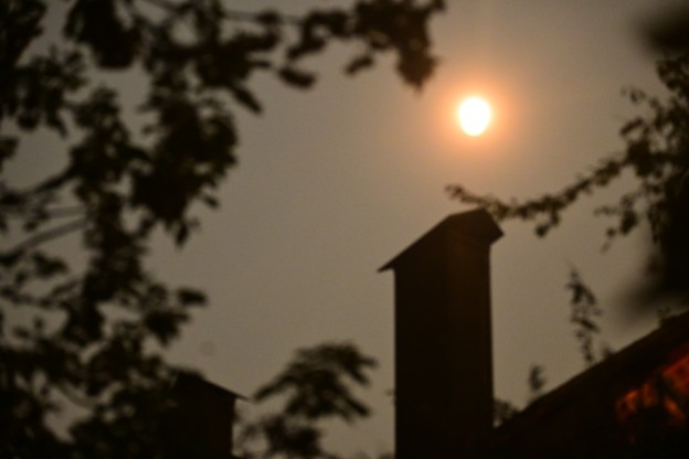 Harvest Moon in California Oct 1st